
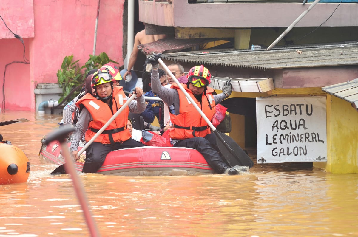
Since the evening of July 19, soldiers from the Spear Corps have moved through chest-deep water across Upper Assam, pulling people from rooftops and ferrying the elderly on inflatable boats through submerged lanes. By July 21, the count stood at 571 rescued, with Dedicated Flood Relief Columns running around the clock. The numbers will climb. They always do.
What the Spear Corps is doing in Upper Assam this week is admirable. It is also, by now, entirely routine — and that routineness is the problem worth examining.
The Machinery That Deploys
The Spear Corps, headquartered in the Northeast, maintains its Dedicated Flood Relief Columns precisely because Assam floods every monsoon without exception. The Ministry of Defence authorises Humanitarian Aid to Civil Authority operations in the region without requiring emergency declarations — the procedural machinery is already greased from prior years. Eastern Command coordinates with the Chief Minister's office as standard operating procedure, not as crisis improvisation. The system works. Soldiers reach people who would otherwise drown.
But the system works as a rescue apparatus, not a prevention one. Rescue operations of this scale recur in the same geography, across the same riverine floodplains, displacing communities that rebuilt from last year's inundation only to be swept out again this monsoon. The Brahmaputra does not surprise anyone anymore. It simply arrives.
Embankments, Allocations, and the Gap Between Them
Assam's vulnerability to the Brahmaputra's annual surge is a documented consequence of embankment infrastructure that has deteriorated faster than it has been repaired. The state has raised this repeatedly, and Chief Minister Himanta Biswa Sarma has called for a permanent Brahmaputra flood-management authority backed by Union government funding, explicitly arguing that state resources are insufficient for what is, structurally, a transboundary and climate-driven problem. That argument is correct and has been made for years. The authority does not yet exist.
The National Disaster Management Authority and the State Disaster Response Fund framework provide relief channels after displacement occurs. What they do not provide is the capital infrastructure — new embankments, reinforced existing ones, early-warning sensor networks along tributaries — that would reduce the quantum of displacement in the first place. There is a difference between a disaster-response architecture and a disaster-prevention architecture. India has built the former with some sophistication in the Northeast. The latter remains skeletal.
The Army's Spear Corps fills the gap between the two. That is an honourable function. It should not be a permanent one.
The River Upstream
There is a dimension to Assam's flooding that sits entirely outside state budgets and NDMA frameworks. The Brahmaputra — called the Yarlung Tsangpo as it crosses the Tibetan Plateau — descends into Arunachal Pradesh and then Assam after passing through one of the most heavily dammed stretches of river in the world. China has built multiple large dams on the upper reaches, and plans for further construction on the lower Yarlung Tsangpo have been announced. The Observer Research Foundation has flagged that this dam infrastructure creates two distinct risks for downstream India: water withheld during lean periods, and sudden releases during high-rainfall events that can overwhelm Assam's plains within hours of any upstream decision.
India and China have a hydrological data-sharing arrangement covering Brahmaputra tributaries, renewed in 2018, that is meant to give Indian forecasters advance notice of high-flow events. The arrangement has been inconsistently implemented. When data arrives late or incompletely, the lead time available to Assam's disaster managers shrinks — sometimes to hours. The difference between a 48-hour warning and a 6-hour warning is the difference between an organised evacuation and a rescue operation.
Sanjoy Hazarika of the Centre for North East Studies and Policy Research has written that upstream data-sharing inadequacy is a governance failure, not merely a diplomatic inconvenience. India's ability to protect its own citizens in Assam is partially contingent on information flows from Beijing. That is a sovereignty question dressed in flood-management language, and it deserves to be treated as such.
The Army's Soft Power — and Its Limits
Retired Lieutenant General Ata Hasnain, who commanded in the region, has argued that the Army's humanitarian operations in border states are a critical trust-building instrument — that soldiers rescuing civilians in Assam, Arunachal, and Manipur build institutional legitimacy that no recruitment poster or civic programme can replicate. He is right. In a region where the state's presence has historically been associated with security operations, the image of a jawan carrying a child through floodwater carries enormous social weight.
But Hasnain has also cautioned against allowing humanitarian operational commitments to crowd out conventional warfighting readiness. The Spear Corps is a fighting formation with a boundary mission in terrain that shares borders with China, Bhutan, Bangladesh, and Myanmar. Every flood season that demands full column deployment is a season during which those same formations are oriented inward rather than outward. The trade-off is manageable in a normal year. It becomes strategically uncomfortable in a year when the northern border is simultaneously active.
The correct resolution is not to pull the Army out of flood relief — that would be politically unthinkable and humanistically wrong. The correct resolution is to build the civilian NDRF capacity in the region to the point where the Army's role becomes supplementary rather than primary. Expanding NDRF battalion presence in Guwahati and Dibrugarh is a concrete step that analysts have recommended repeatedly. It has not been executed at the necessary scale.
Act East and the Flood Problem
India's Act East Policy positions the Northeast as the gateway to Southeast Asian trade — a logistics corridor, an investment frontier, a demonstration that connectivity ambitions translate into economic reality. Persistent annual flooding that displaces populations, damages roads and rail links, and deters long-horizon investment undermines that strategic narrative directly. A region that requires Army-led rescue operations every monsoon is not, in the eyes of potential investors or partner governments, a stable platform for economic integration.
This is not an argument against the Northeast — it is an argument for taking its infrastructure deficit seriously enough to fix it. The Brahmaputra basin's flood vulnerability is manageable with sustained capital investment, a functioning early-warning system fed by reliable upstream data, and a civilian disaster infrastructure that does not depend on military columns as its primary instrument. None of these are beyond India's institutional capacity. They require prioritisation that matches the scale of the problem.
Five hundred and seventy-one people are safe tonight because soldiers waded into the water and brought them out. That is the immediate story. The structural story — why those people needed rescuing at the same time, in the same places, for the same reasons as last year and the year before — is the one that demands an answer before the next monsoon arrives.