
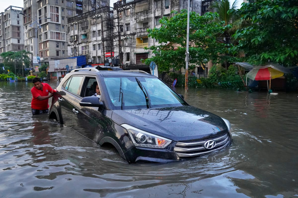
On Wednesday, the India Meteorological Department issued a low-to-moderate flash flood risk warning for dozens of districts across Chhattisgarh, east Madhya Pradesh, Vidarbha, and Odisha, valid until 11:30 am on 30 July. The warning cited heavy rainfall falling on already saturated soils — the precise combination that produces surface runoff faster than rivers or drainage channels can absorb it. Nineteen districts in Chhattisgarh were named, stretching from the mineral-rich plateaus of Bastar and Dantewara in the south to Raipur and Raigarh in the north. Thirteen districts in east Madhya Pradesh were included — Jabalpur, Balaghat, Mandla, Dindori, among them — along with six in Nagpur's Vidarbha hinterland and sixteen in Odisha, from the coastal districts of Baleshwar and Bhadrak to the interior belts of Kandhamal and Kalahandi.
These are among the most topographically susceptible stretches of peninsular India: shallow rivers cutting through hard laterite and basalt, with soils that drain slowly and hillsides that shed water fast. When the monsoon intensifies after a subdued opening — which the IMD has indicated was the pattern this season — the accumulated moisture in the soil leaves almost no buffer. The next rain event does not percolate; it runs.
The Monsoon's Widening Arc
The IMD's broader forecast maps an active phase extending well beyond the central belt. Isolated heavy rainfall is expected over west Madhya Pradesh on 30 July and the Gujarat region on 31 July. Northwest India — Himachal Pradesh, Jammu and Kashmir, Ladakh, and Uttarakhand — faces fairly widespread to widespread rainfall from 30 July through 3 August. Haryana, Chandigarh, Delhi, and Punjab are in the frame for 30-31 July and again on 2-3 August. East Rajasthan and west Uttar Pradesh should see wet conditions through 3 August; west Rajasthan gets its turn on 1-2 August.
In central India specifically, Vidarbha and west Madhya Pradesh face widespread rainfall through 1 August, east Madhya Pradesh through 2 August, and Chhattisgarh through 3 August. The southwest monsoon, which accounts for more than 70 per cent of India's annual precipitation, is entering what could be its most consequential stretch of the season — particularly for a country where the monsoon's timing and distribution shape agricultural, infrastructural, and fiscal planning across government.
Agriculture at the Pivot Point
The timing is critical. Kharif sowing — paddy, soybean, cotton, pulses — is at its most vulnerable stage across the warned regions. Chhattisgarh is among the country's leading paddy producers, with a rural economy where the monsoon is not background weather but the primary economic event of the year. East Madhya Pradesh and Vidarbha carry similar agricultural weight; Vidarbha in particular has a documented history of agrarian distress that makes any crop disruption politically and economically significant far beyond district revenue offices.
Flash flooding at this stage of the season does not simply damage standing crops. It can delay re-sowing, waterlog fields long enough to kill transplanted seedlings, and wash away fertiliser applications that farmers cannot easily reapply. The downstream effect runs through crop loan repayment cycles and into rural bank balance sheets. In this region, the margin between a good harvest and a debt spiral has historically been thin, and state governments have repeatedly invoked loan waiver programmes when the monsoon misaligns with the crop calendar. A sequence of flash floods in late July and early August converts a normal monsoon year into a distressed one in the affected pockets.
Odisha's Hard-Won Edge — and Its Limits
Among the warned states, Odisha occupies a specific position. Since the 1999 super-cyclone, successive administrations in Bhubaneswar have rebuilt the state's disaster preparedness infrastructure from near-zero into one of India's more capable systems — early evacuation protocols, a dense network of cyclone shelters, a trained Odisha Disaster Rapid Action Force. The international disaster management community has used Odisha as a reference case.
But that infrastructure was engineered primarily around cyclonic events, which move slowly enough to permit 48-72 hour evacuation windows. Flash floods operate on a different timescale. A heavy rainfall event over the upper catchments of the Mahanadi, Brahmani, or Baitarani river systems can translate into inundation of downstream districts within hours, not days. The lead-time advantage that Odisha built its preparedness model around compresses almost to nothing. Districts like Dhenkanal, Kendujhar, and Sundargarh — all named in Wednesday's warning — sit in river corridors where this compression is a known hazard, and where even a state with Odisha's institutional capacity can find its response systems strained.
The Gap That Forecasting Alone Cannot Close
India's meteorological capability has advanced substantially. The IMD now issues district-level flash flood guidance, a tool that would have been operationally unavailable a decade ago. The shift from regional to district-level resolution is a genuine institutional achievement. The department has also signalled intent to extend AI-assisted forecasting tools to give farmers longer advance warning before monsoon intensification events.
Yet the science is outpacing the dissemination infrastructure. A flash flood guidance system that reaches the district collector's office but not the village-level common service centre, or the sarpanch's phone, or the local radio station that farmers actually hear, is a forecasting achievement that does not fully translate into lives and livelihoods protected. The IMD can name Balod and Bastar and Gariaband with precision. Whether the people in those districts receive actionable warning in time to move cattle, shift stored grain, or vacate low-lying settlements depends not on atmospheric science but on the state of last-mile communication infrastructure — and that infrastructure, across much of central India, remains patchy.
This is not a criticism of any single institutional actor. It is a structural feature of how India's disaster-warning architecture evolved: national capability concentrated at the top, state-level response forces constituted and increasingly well-trained, but the intermediate layer — the one that converts a district-level alert into a village-level action — still underdeveloped in many of the regions most at risk. The gap is known and documented by researchers working on climate risk and early-warning systems. The question is whether it receives the budgetary and administrative attention it requires before the next active phase arrives.
The Credibility Argument
India has positioned itself, through successive Voice of Global South summits and multilateral climate forums, as a country that understands what climate vulnerability means for developing nations — not as an abstraction but as a material condition of daily life. That positioning is credible; India genuinely inhabits both ends of the climate equation, as a country with ambitious mitigation commitments and as one whose hundreds of millions of people live inside the climate's variance in ways that most of the developed world does not.
The domestic corollary of that international stance is a functioning early-warning system that reaches the people most exposed to climate-driven extremes. Central India's tribal districts, its rain-fed farming belts, its river-plain settlements — these constituencies determine whether India's climate leadership rests on institutional substance or remains primarily rhetorical. The IMD's district-level guidance is a necessary step. Getting it to the last mile, consistently and fast enough to matter when the laterite sheds water in July, is what comes next.